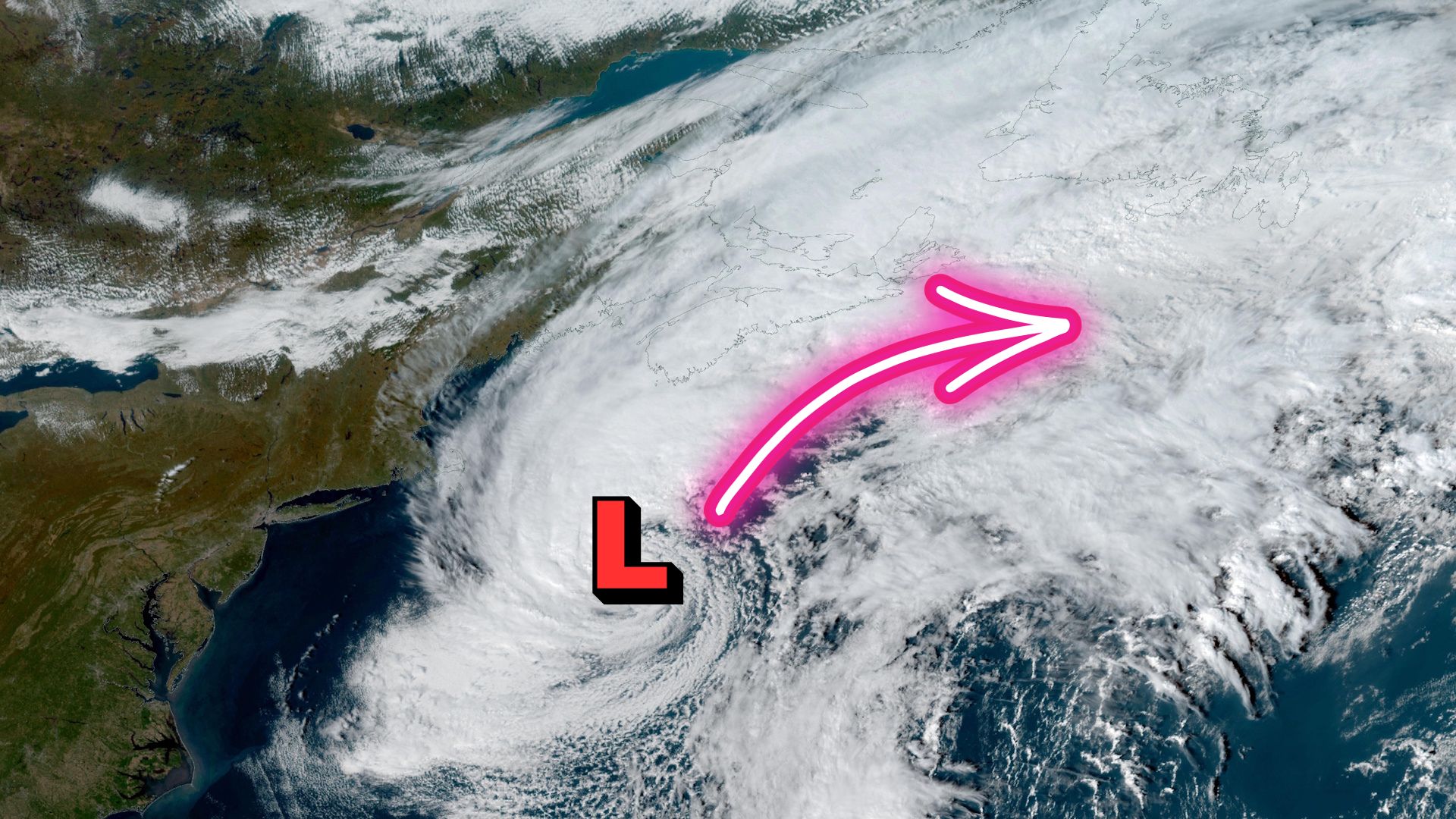
A shape-shifting autumn system is forecast to strengthen into Friday, bringing gusts up to 100 km/h, rain-snow mix in parts of Newfoundland and waves high enough to threaten coastal flooding.
The ex-Josephine storm, the system that briefly carried the name Subtropical Storm Josephine, is bearing down on southern Atlantic Canada with heavy rain, damaging wind gusts and pounding surf. Nova Scotia and Newfoundland face the greatest risk as the storm strengthens through Friday, October 23, 2026.
Forecasters say the system will lash the region with gusts that could reach 100 km/h in parts of Newfoundland, rainfall totals of 20 to 50 millimetres or more, and waves of three to five metres along exposed coastlines. Together, those conditions raise the threat of coastal flooding, fallen trees and widespread power outages.
Although Josephine no longer holds a name, forecasters stress that losing its tropical label has done nothing to soften its punch. The storm is expected to keep intensifying as it moves past the region, with winds reaching Category 1 strength offshore.
How Josephine Shifted From Nor’easter to Subtropical Storm and Back
Josephine’s path has been unusual. The system spent the week drifting up the Eastern Seaboard as a powerful low-pressure area. It began as a strong nor’easter, picked up enough tropical traits to be classified as a subtropical storm on Wednesday, October 21, and then reverted to a non-tropical storm on Thursday.
Meteorologists place low-pressure systems on a spectrum. At one end are tropical systems, such as hurricanes, which draw energy from warm ocean water. At the other end are extratropical, or non-tropical, storms, which feed on temperature contrasts between air masses. Josephine has slid back and forth along that spectrum more than once in the past week.
A subtropical storm sits between the two. It is a hybrid that combines features of both types, and it can still produce dangerous weather. As Josephine settles back into a non-tropical structure, it is behaving more like a classic autumn gale: large, windy and wet.
Ex-Josephine Storm Timeline: Rain Moves From Nova Scotia to Cape Breton and Newfoundland
Rain reached Nova Scotia on Thursday morning and is forecast to spread eastward, arriving in Cape Breton overnight and continuing into Friday morning. In southeastern Newfoundland, rain bands are expected to linger until late Friday.
Forecasters say both regions could see 20 to 50 millimetres of rain, with some areas getting more. The table below brings together the main forecast details by area.
| Area | Rain timing | Expected rainfall | Peak wind gusts |
|---|---|---|---|
| Mainland Nova Scotia | Began Thursday morning, moving east | 20-50+ mm possible | 50-90 km/h, strongest on the south coast, peaking Friday morning |
| Cape Breton | Arriving overnight Thursday, continuing Friday morning | 20-50+ mm possible | 50-90 km/h range for the Maritimes, peaking Friday morning |
| Southeastern Newfoundland | Rain bands persisting through late Friday | 20-50+ mm possible | 70-100 km/h, locally higher on the southeastern coast |
| Central Newfoundland and Burin Peninsula | Through Friday | Rain, with a rain-snow mix at times | Rising Friday morning and strengthening through the day |
These figures are forecasts made as the storm approached. Totals and wind speeds can change as the system develops, so residents should check the latest local updates before making travel or safety decisions.
Snow in the Mix for Central Newfoundland and the Burin Peninsula
Josephine’s late-season timing brings a wintry twist. As the storm passes, colder air is expected to wrap in behind it. That could turn rain into a rain-snow mix at times in central Newfoundland and on the Burin Peninsula through Friday.
No snowfall totals have been specified. Even so, a mix of wet snow and strong winds can add stress to trees and power lines that may still be in leaf. Roads could also become slippery in places where temperatures fall near freezing.
Gusts Up to 100 km/h and Category 1-Strength Winds Offshore
Forecasters have identified wind as one of the storm’s main hazards. Here is how the wind is expected to build across the region:
- The Maritimes: Winds are forecast to pick up late Thursday and peak Friday morning, with gusts of 50 to 90 km/h. The strongest gusts are expected along Nova Scotia’s south coast.
- Newfoundland: Gusts are expected to rise on Friday morning and strengthen through the day, reaching 70 to 100 km/h. Some spots on the southeastern coast could see higher gusts.
- Offshore waters: As the storm deepens into Friday, winds over the open ocean are expected to reach Category 1 strength.
General context: On the Saffir-Simpson scale used for hurricanes, Category 1 refers to sustained winds of roughly 119 to 153 km/h. A Category 1 comparison does not make ex-Josephine a hurricane. It signals that winds over marine areas could be strong enough to create serious hazards for shipping, fishing fleets and offshore operations.
Three- to Five-Metre Waves Raise Coastal Flooding Concerns
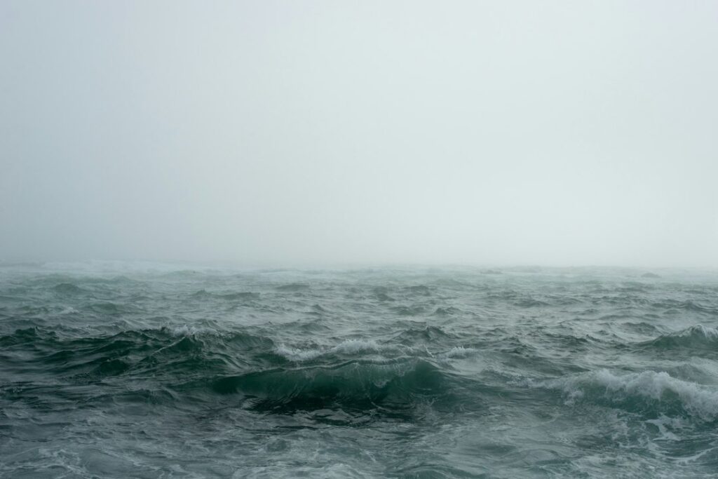
Strong onshore winds are expected to drive up the sea. Waves and swells could reach three to five metres along coastal areas, which increases the risk of coastal flooding where they meet the shoreline.
Low-lying waterfront roads, wharves and shoreline properties are usually the first places affected when high surf combines with heavy rain. Forecasters have not issued specific storm surge figures or listed which communities are most exposed. People living near the coast in southern Nova Scotia and southeastern Newfoundland should pay close attention to local advisories.
Power Outages and Fallen Trees Expected Across the Region
Forecasters say widespread power outages and tree damage are possible. Gusts of this strength, along with soaked ground that weakens root systems, can bring down branches and whole trees onto lines and roads.
General preparedness guidance (not specific to this forecast) for households in the storm’s path includes:
- Charge devices early: Fully charge phones and battery packs before the strongest winds arrive.
- Secure outdoor items: Bring in or tie down patio furniture, bins and decorations that could be blown loose.
- Keep basic supplies on hand: Have flashlights, batteries, drinking water and non-perishable food ready for at least a short outage.
- Stay away from downed lines: Treat every fallen wire as live and report it to your local utility.
- Follow official alerts: Watch for warnings from Environment and Climate Change Canada and your municipality, as conditions can change quickly.
Why Late-Season Hybrid Storms Keep Testing Atlantic Canada
Josephine is the latest reminder that the end of summer does not mean the end of serious storm risk on the East Coast. Autumn systems that blend tropical moisture with cooler, non-tropical energy can cover large areas and bring rain, wind, waves and even snow in a single event.
For businesses and communities in the region, these storms are increasingly part of planning for operations, insurance and infrastructure. Our recent look at how fire, flood and heat are redrawing Canada’s extreme weather risk map explores how events like this are changing the way Canadians assess climate risk.
Seasonal outlooks are also shaping expectations for the months ahead. Forecasters have been discussing whether El Niño could affect the strength of nor’easters this coming winter. That question is still open, and no firm conclusions have been drawn. For now, attention is on getting through Friday safely.
Frequently Asked Questions
Is Josephine still a named storm?
No. Josephine was a subtropical storm on Wednesday, then returned to a non-tropical structure on Thursday and no longer carries a name. It is still expected to bring hazardous wind and rain.
Which areas face the biggest impacts?
Nova Scotia and Newfoundland face the greatest risk. The strongest Maritime gusts are expected on Nova Scotia’s south coast, and Newfoundland’s southeastern coast could see gusts above 100 km/h in places.
When will conditions be at their worst?
Winds in the Maritimes are forecast to peak on Friday morning. In Newfoundland, gusts are expected to strengthen through Friday, and rain bands should last until late in the day.
How much rain is expected?
Forecasters say 20 to 50 millimetres or more is possible across Nova Scotia and southeastern Newfoundland. Central Newfoundland and the Burin Peninsula could also see a rain-snow mix at times.

The Brand Magazine Newsroom covers Canadian business, markets and policy news for brand builders and entrepreneurs. Newsroom reports are produced from published public sources such as company releases and government and regulator publications, and follow our Editorial Standards.